
The Karakoram Highway is not only a route that passes through the north of Pakistan. It is a journey through some of the most stunning alpine scenery on earth. The Karakoram Highway, formally the China-Pakistan Friendship Highway, is 1,300km long and was finished in 1979 and opened to the public in 1985. It links Hasan Abdal (a few kilometers past Islamabad, the capital of Pakistan) with Kashgar, the second largest city in the Xinjiang province of China. According to Pakistan’s official tourism page, Khunjerab is one of the highest paved international border crossings in the world.
For the adventurous traveler, the Karakoram Highway (commonly abbreviated to KKH) provides an amazing mixture of snow clad mountains, glacial scenery, turquoise lakes, historic communities and trekking options. It goes to or gives access to areas like Gilgit, Nagar, Hunza, Attabad Lake, Gulmit, Passu and Sost before the ascent up Khunjerab.What was once a vital “Silk Road” route linking the Indian sub-continent with China is today regarded as the 8th wonder of the world, as the altitude and the harsh conditions under which it was built have rendered it an architectonic marvel.
The Karakoram Highway: A Road Through the Mountains
The Karakoram Highway traces an old mountain corridor that linked towns and trade routes between South and Central Asia. The current highway, finished in the late 1970s, supplanted some segments of old Silk Road connections, says Gilgit-Baltistan’s tourism bureau.Today the road connects Pakistan with western China, and it is the key travel artery across much of Gilgit-Baltistan. The road is characterized in official Pakistan tourism material as linking Islamabad with Kashgar through towns and valleys including Abbottabad, Mansehra, Chilas, Gilgit and Hunza.
The Karakorum Highway has been attracting people from all over the world for decades. Not only because it is the highest hard road in the world (4,800m at Khunjerab Pass) but also because it runs through the three biggest mountain ranges on Earth: the Himalayas, the Karakoram, the Hindu Kush. The Karakoram Highway is arguably one of the only sites in the world where you can observe a mountain 8,000 meters high, like Nanga Parbat, from the car window easily .
The Karakoram Mountains: Giants of Northern Pakistan
The northern views are amazing, the traditions are centuries old, and the adventure options are promising in Pakistan. Think of gigantic mountains like K2, Nanga Parbat, Rakaposhi, inviting climbers and trekkers from all over the world. But it’s not just the peaks: luscious valleys like Swat, Chitral, Hunza, Skardu and Swat dazzle with verdant meadows, frozen lakes and villages where hospitality feels like home.The lakes here are magnificent. Great for boat cruises or relaxing picnics are the azure waters of Attabad, mirror-like surface of Sheosar and fabled charm of Saif-ul-Muluk.
Further north the scenery around Passu is always amazing. With their pointed ridges, the Passu Cones are one of the most recognizable mountain views in northern Pakistan.The difference is indescribable: jagged dark granite towers to the sky, glaciers and snow-covered peaks fill the background.The low angle light of sunrise and late afternoon may be very rewarding for photographers, bringing out the texture of the karakoram mountains and the walls of the valley.
Snow-Capped Mountains Along the Karakoram Highway
The snow-capped mountains are one of the signature sights of a Karakoram Highway journey.Even in the summer months several of the higher peaks are covered with permanent snow fields and glaciers. Travelers may be motoring through dry, sunlit valleys, gazing up at white summits thousands of meters above them.In Hunza, Nagar and Upper Hunza, mountain scenery is virtually everywhere can be seen.
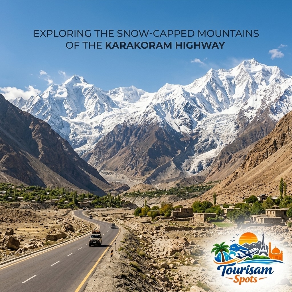
Rakaposhi towers over the Nagar Valley and Passu gives views of high Karakoram peaks, glaciers and jagged ridges. The road to Khunjerab leads travelers into an ever more high-altitude scenery surrounded by large mountain slopes and snow-capped summits. The official tourism portal of Pakistan makes specific reference to Khunjerab Pass’ snow-capped peaks and alpine surroundings.The mountains are gorgeous, but they also affect the ecosystem.Snow can block roads. Cold weather can melt snow and ice and raise river levels. On steep slopes, especially following extreme weather, rockfalls and landslides can occur.That is why the mountains should be regarded with reverence, not only as a background.
Unpredictable Weather on the Karakoram Highway
The erratic weather is one of the major difficulties of traveling over the Karakoram.Conditions might vary drastically from valley to elevation. A warm afternoon in Hunza does not mean a nice time at Khunjerab Pass.The road climbs quickly and temperatures can dip. Higher elevation winds can make it feel considerably colder while lower valleys may be rather pleasant with snow or ice occurring.
Weather in the mountains can also alter the road conditions. The UK’s current travel advice for Pakistan states landslides are common in northern Pakistan and advises employing experienced local drivers and traveling in good weather on challenging mountain routes.For guests, flexibility is the greatest option.Take layers, not one thick coat. 4. Even while traveling in summer a lightweight thermal layer, waterproof outer layer, warm cap and gloves can come in handy.Also avoid planning an itinerary where you have to arrive at every stop on the hour. Mountain travel involves delays, and a road trip that seems easy on a map may take significantly longer because of construction, weather or landslip cleanup.
Altitude Sickness: A Risk Travellers Should Take Seriously
Altitude is also a major concern on the Karakoram Highway.The road eventually climbs to about 4,693 meters at Khunjerab Pass, and many popular settlements are high above sea level.At those altitudes, there is less oxygen available than at sea level.The UK’s health advice for Pakistan particularly advises that altitude sickness is a possible concern in Gilgit-Baltistan.Symptoms may include headaches, weariness, dizziness, nausea, problems sleeping and unexpected shortness of breath. Travelers should not dismiss symptoms because they are short of time.
A better itinerary permits the body to adapt.It may be wiser to spend some time in Gilgit or Hunza before setting off on a long trek toward Khunjerab than to rush straight from low altitude to the highest point on the roadway.Drink enough water, avoid strenuous activity right after arrival at altitude and pay attention to your condition. Those with serious or worsening symptoms should go downward and get proper medical help instead than continuing upward.Khunjerab is stunning but never is getting to a certain vista more vital than personal safety.
Glacial Lakes Along the Karakoram Highway
Karakoram is a realm of ice, water and rock, and the glacier lakes hold some of the most stunning scenery in the region.Attabad Lake is the most notable example along the KKH.Attabad Lake is situated in the Gojal area of Hunza. It was created due to the massive landslip in January 2010 which blocked the valley. Today its deep blue water has made it one of the most visited tourist attractions of Gilgit Baltistan.The contrast between the turquoise lake and the bleak mountains is stark.
Visitors may take a break at overlooks, lounge at the shore or engage in recreational activities including boating. Gilgit-Baltistan’s tourism authority identifies significant attractions of Hunza as Attabad, Passu, Gulmit, Altit Fort and Baltit Fort.Further north, Borith Lake offers a more serene landscape near Passu and the nearby glacier region.These lakes are wonderful reminders of the forces that still create the Karakoram today. Glaciers feed rivers and valleys . Changing ice conditions and landslides can significantly affect the terrain.
Hunza Valley: The Heart of the Karakoram Highway Experience
For many people who come here the Hunza Valley is the best thing about the whole trip.The valley features magnificent landscapes, medieval communities, orchards, mountain vistas and access to a number of notable attractions.Karimabad is a popular starting point for exploring central Hunza. Baltit Fort and Altit Fort are historical sites giving tourists a glimpse of the region’s cultural side, and adjacent Duikar offers expansive views over the valley. Gilgit-Baltistan official tourism page promotes Duikar especially for dawn, sunset and night-sky views.
Further north the roadway crosses Attabad Lake before coming to Gulmit and Passu.The journey by road is part of the experience.The traveler may be past little villages and fruit trees at one point; a short distance further on he may find himself surrounded by massive rock cliffs, rivers and glaciers.Rather than rushing through Hunza as a sightseeing stop, spending a few days in the valley allows you to take in the beauty at a leisurely pace.
Famous Hikes Near the Karakoram Highway
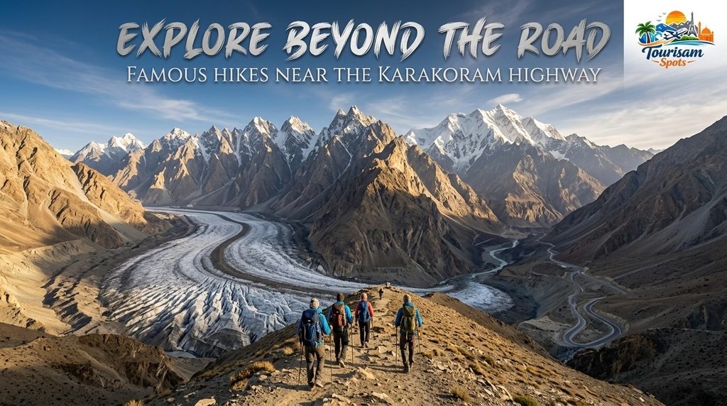
One option to explore Karakoram is to drive on the roadway. Hiking opens the region up in a totally other way.
Passu Glacier Trek:
Passu Glacier is one of the easiest places for a walk in the Upper Hunza area.Several hikes offer views of the glacier and neighboring mountains. Some of the shorter approaches can take well under an hour depending on the chosen trail, while longer routes can continue toward high meadows and more hard mountain terrain. The latest trekking advice is of a fairly straightforward route from Passu to the lower glacier area in about 30-45 mins.Travelers should not step straight onto glacier ice without sufficient competence. Glacier walking may appear simple, but it can be hazardous because of crevasses, loose rock and unstable surfaces.
Borith Lake and Passu Glacier:
The Borith Lake environs are linked to another beautiful hiking region, with views toward the Passu Glacier.Routes here have views of Karakoram peaks, Hunza Valley and glacier terrain. More difficult sections may include loose moraine therefore local advice can be valuable for travelers who are not used to high mountain trails.
Patundas:
For the experienced hiker a bigger adventure is to hike toward Patundas, a high meadow area between the Passu and Batura glacier systems.This is a much more serious matter than a brief roadside walk and demands thorough planning, awareness of the weather and ideally the direction of experienced locals.
Rakaposhi Base Camp:
The Rakaposhi region is also a magnet for trekkers who want to get closer to one of the grand peaks of the Karakoram. The routes through the Nagar area give a significantly different outlook from just stopping at the roadside Rakaposhi View Point.
Fairy Meadows and Nanga Parbat:
Travelers on the wider KKH route often add Fairy Meadows and Nanga Parbat to their itinerary in northern Pakistan.The access is from the Raikot area rather than right next to the main Hunza attractions, and getting to Fairy Meadows requires separate road conveyance and hiking.The trekking conditions are subject to snow, rain and landslides, therefore visitors should constantly check current local trail conditions before starting out.
Khunjerab Pass: The High Point of the Journey
The route north reaches Khunjerab Pass (near the Pakistan-China border).At around 4,693 meters, the terrain is totally different from the greener parts of Hunza.Vegetation is limited. The sky can look unnaturally bright and snow can still be seen even in warm lower regions.For many travelers the road adventure ends symbolically standing on the border and encircled by the Karakoram Mountains.
But, tourists should be aware of the altitude. It is wise to take cautious precautions. Walk carefully, dress warmly, avoid needless exertion.Border processes, road access and opening times can also change so travelers should check current official local information before departure.
Best Time to Visit the Karakoram Highway
Best time to visit Karakoram Highway?Most travelers to Hunza, Passu and the upper highway find late May through September generally the best combination of road access and comfortable sightseeing conditions.
April to May: Spring
In spring, when the fruit trees start to flower and the lower valleys become colorful, Hunza is very lovely.Temperatures are still likely to be cold, especially at night and higher portions to Khunjerab might still be experiencing winter conditions.
June to August: Main Travel Season
The main valleys are warmer in summer, and better suitable for hiking.It is also one of the busiest times.“Warm weather doesn’t eliminate mountain hazards, and visitors should keep that in mind. Heavy rain, melting snow, landslides and high river levels can often lead to disruptions on the roads.
September to October: Autumn
Early fall may be one of the most attractive times for landscapes and photography.Trees in Hunza change color, skies can be stunningly clear and the number of visitors may begin to dwindle.Nites are getting colder and colder, especially in upper Hunza.
November to March: Winter
Winter makes the Karakoram a far more formidable environment.Travel in high elevations can be impacted by snow, ice, cold temperatures and road closures. A few tourism services might also be cut back to a limited schedule.The warmer part of the year is often easier for a first Karakoram Highway journey unless the tourist has specific winter travel experience and up-to-date local information.
Tourisam Spots: Exploring the Karakoram Highway
Tourisam Spots is a travel and tourism blog, which is covering beauty, culture, locations and adventures of Pakistan, especially covering Karakoram Highway, Hunza and beautiful areas like Attabad Lake. We share interesting and helpful travel articles to help our users find great places and plan unforgettable trips. Apart from travel guides, we also provide expert Guest Posting and Content Writing services for travel, tourism, lifestyle and related industries. If you want to spread your brand to a larger audience or need excellent material for your website, Tourisam Spots is here to help you. You can discover more about our platform here About Us and Contact Us for guest posting, content authoring or cooperation opportunities.
Conclusion
The journey down the Karakoram Highway is considerably less about reaching a destination. It’s about seeing huge mountains appear around a bend, standing next to gorgeous blue water, seeing glaciers come down between black walls of rock and traveling through valleys where communities look tiny under the surrounding hills. It’s about accepting the unpredictability, too.
The weather can change. A landslip can modify the path for the day. You might want to slow down for the altitude. A two hour drive planned can turn into a whole afternoon. Yet these same features also make for the sense of adventure that makes the Karakoram Highway a remarkable experience. From Rakaposhi and the Hunza Valley to Attabad Lake, Passu, glacier terrain and Khunjerab Pass.
FAQS
What’s the Karakoram Highway?
The Karakoram Highway is a breathtaking mountain road between Pakistan and China. Its majestic peaks, deep valleys, glaciers, rivers and stunning beauty are famous.
What are the main attractions of the Karakoram Highway?
Popular places of interest are Hunza Valley, Attabad Lake, Passu Cones, Khunjerab Pass, Rakaposhi vista points and some beautiful mountain towns.
When is the ideal time to travel on the Karakoram Highway?
Generally, spring, summer and early autumn are popular months to travel the route as many mountain places areeasier to reach and better for sightseeing.